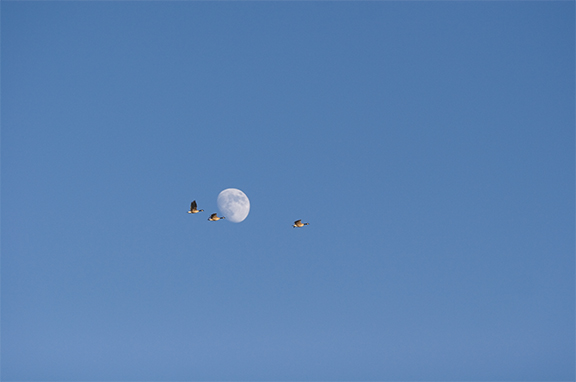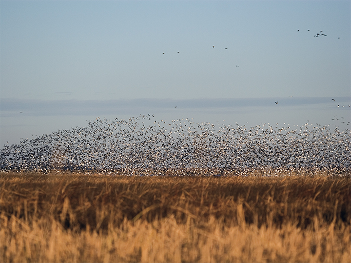
Some five billion migratory birds wing their ways along four major North American flyways. Kansas wetlands are key refueling stopovers.
Migratory behavior has long been noted with awe. The journeys of Atlantic salmon from their freshwater birthplaces to the open ocean and back to their natal waters; the treks of African wildebeest, some 1.5 million srong, moving from plains to woods then back as summer rains water the grasslands; the travels of tens of millions of eastern monarch butterflies that each spring start north from wintering sites in Mexico on an epic search for milkweed, the only plant species on which the females will deposit eggs for the next generation: Each of these migratory patterns kindles amazement. Yet it is the sheer number of migratory birds that makes their migrations paramount in our thoughts on the subject.
No one knows with any certainty just how many birds annually traverse the Central Flyway, one of four main North American avian thoroughfares. This grand flyway, with its common endpoints being central Canada’s nesting grounds and wintering sites surrounding the Gulf of Mexico (its extremities are the northwest Arctic coast and Patagonia), generally follows the vast trace of the Great Plains.
Premier among the flyway’s middle-of-the-route feeding and resting sites are two Kansas wetland complexes, Quivira and Cheyenne Bottoms, both deemed Wetlands of International Importance by the Ramsar Convention.
“Cheyenne Bottoms, Quivira — even the restored shallow marshland at the university’s field station — are important stopover sites for migrating birds,” says Chris Rogers, WSU’s resident avian biologist and an associate professor of biological sciences who describes his academic focus as studying “the hypotheses and patterns, the ecology and evolution of birds.”
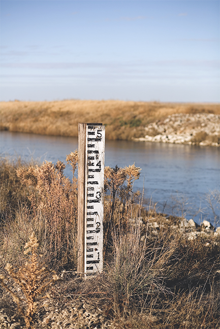
ridden Great Plains, Quivira and Cheyenne
Bottoms are managed sites with long
histories of issues with water.
Rogers’ list of courses taught includes environmental science, general ecology, vertebrate zoology and animal behavior as well as avian biology. He takes students in his bird class on an all-day field trip to Quivira, some 70 miles northwest of Wichita as the goose flies.
The wetland complex is a national wildlife refuge, with 22,135 acres of mixed-grass prairie, fresh and saltwater marshes, salt flats, canals, dikes, agricultural fields and woodlands managed by the U.S. Fish and Wildlife Service. The site features two ancient basins that are now large salt marshes, rare habitat for the region.
“At Quivira, we see great flights of ducks and geese, migratory shorebirds, hawks, herons, the occasional eagle, owls,” says Rogers, a Wisconsin native who became interested in birds “just naturally as a lad” and admits to earning all the nature-related badges while in Boy Scouts. In college, he studied zoology and then specialized in birds; he’s been a WSU faculty member since August 2000.
“Wetlands are productive ecosystems,” he says. “Plants, ducks, geese, shorebirds and the conservation of these are what we study in stopover ecology. We’re interested in what habitats migratory birds use for refueling in the spring and fall.”
Quivira, he notes, offers critical habitat for more than 300 bird species and is an important breeding area for the snowy plover, six species of rails, 14 species of ducks, 10 species of herons, the white-faced ibis, two species of grebes and the endangered least tern.
Other endangered or threatened species seen at Quivira include the bald eagle, peregrine falcon, whooping crane and piping plover. As semipermanent wetlands on the drought-ridden Great Plains, Quivira and nearby Cheyenne Bottoms — a Western Hemisphere Shorebird Reserve managed in part by the Kansas Department of Wildlife and Parks and partly by the Nature Conservancy — have always had issues with water. Thus, they are both “managed wetlands,” Rogers says.
At Quivira, water enters the complex via Rattlesnake Creek and flows into the Little Salt Marsh. From there no fewer than 80 water control structures and 21 miles of canals regulate water-levels in 34 distinct wetland units within the refuge.
At Cheyenne Bottoms, water from Blood Creek and Deception Creek drainages flows into a 41,000-acre basin formed 80 million to 100 million years ago. The freshwater marshland portion covers 19,857 acres in the lower part of the basin and is held by the state of Kansas. Because the principle natural inflows to the basin are intermittent, dikes were built in the early 1950s to form interconnected pool areas, and a jerry-rigged canal was finished in 1957 to bring in water from Walnut Creek and the Arkansas River, about 23 miles away.
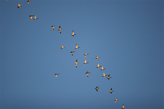
Mallard (Anas platyrhynchos) is a dabbling
duck and a common visitor to Quivira,
Cheyenne Bottoms and WSU’s field station.
That additional water allows the state to manage the lower basin as a permanent wetland — at least in theory. But the lack of continuous flow in the Arkansas River and Walnut Creek (as well as other factors) makes management of the state land difficult.
Although the state owns rights to a total of just under 50,000 acre-feet of water from those two sources, other water-rights holders (primarily irrigators) appropriate 450,000 acre-feet of water, leaving little for Cheyenne Bottoms.
Fall 1991 marked the first time the site was dry for waterfowl season since the Kansas Department of Wildlife and Parks began managing the area in the 1950s. (The state began its acquisition of land at the Bottoms even earlier.) In January 1992 a landmark ruling ordered cutbacks in irrigation to allow more water to reach the reserve.
In 1990, spurred on by the fact that between 1955-78 about 40 percent of the wetlands in Kansas disappeared, The Nature Conservancy began purchasing land at Cheyenne Bottoms’ higher elevations in a step toward reversing that trend.
Today, despite continuing challenges with water and problems with out-of-control plants (cattails are an example), the marshes, mudflats and grasslands of Cheyenne Bottoms are considered one of the most important stopover sites for shorebirds in the entire Western Hemisphere.
About 45 percent of all migratory shorebirds nesting in North America stop at the Bottoms, where, depending upon the year, hundreds to thousands of acres of mudflats are available for the birds to forage for the larvae of chironomids (those insects that collectively grow up to be black swarms of midges).
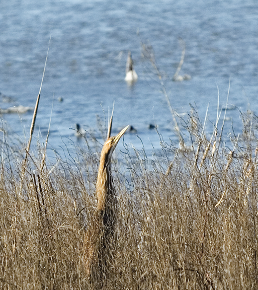
lentiginosus), makes rarer
appearances. Its population is
declining due to loss and
degradation of habitat.
Some years, Cheyenne Bottoms and Quivira together host more than 90 percent of the world’s population of such shorebird species as stilt sandpipers (Calidris himantopus) and white-rumped sandpipers (Calidris fuscicollis).
On a smaller scale, Wichita State’s biology field station, located 35 miles southwest of campus, comprises about 330 acres of native and restored prairie and riparian woodland along a mile stretch of the Ninnescah River — and attracts 120 species of birds.
Some years ago, station director and associate professor of biology Don Distler took the lead in restoring wetlands at the site, an enterprise he began by plugging a small stream that meanders across 40 acres of native grassland. The water pooled into the stream basin and along its tributaries, creating a marshland. “In the fall,” Distler notes, “we’ve had as many as five thousand mallard.”
The field station offers a myriad of research opportunities. For Rogers, it’s the site for two projects. He explains in brief that one focuses on the “winter ecology of small birds” and the other targets the “ecology of West Nile virus in natural bird populations.” He adds, “At the field station, there are vernal pools that serve as a natural laboratory for the West Nile virus, an emerging pathogen.”
Distler and Rogers learned Feb. 1 that WSU received a $240,000 grant from the National Science Foundation to build a 3,500-sq-ft lab at the field station. They will break ground in July 2008 — just months before the crest of another grand season of fall migrations.

